|
|
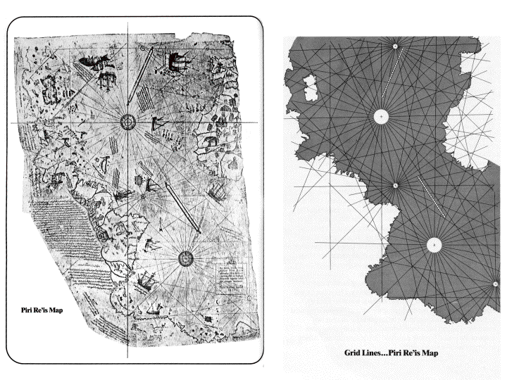
| Insights into this geometry were first recorded in the 1400's by a seafaring navigator named Piri Re'is. The spacial accuracy of his maps was not exceeded for more than 300 years. A grid-work overlaying the coast lines was the geometric key to Piri Re'is mapping system. |

 |